Saturday, June 9, 2007

Community Center

The Community Center occupies the East edge of the site at midpoint. This is where Michel Torena bends and becomes California Street. This is the site of the previous hospital auditorium and the old ER ambulance entry.

Many visitors first recognize the site as a public facility from this vantage point. Therefore this was a good place to site a new entry plaza and a large public use building.

There is a steep grade change here that allows both floors to have at grade access for accessibility. Large windows on the ground floor fold up into the ceiling to create a open pavilion.

The upstairs rooms follow the angle of California Street while the lower floor follows the angle of Michel Torena. The materials are of recycled concrete and timber left in a rough and aged appearance.


Friday, June 8, 2007

Row Houses

The Row Houses are designed to present a solid concrete wall to the South and the West to control solar heat gain. The East and North sides are simple wooden screens that can open a majority of the wall to light, breezes, and social interactions. However, the South facade also includes a large shuttered window opening to allow users to access the ocean views and to invite the cool evening breezes.

The buildings incorporate underground parking either from the remaining hospital garages or by new carport style ground floors. The concrete walls incorporate multiple living space necessities and are "wet walls" for plumbing and electrical. This leaves the North and East portions simple and light to float over the hillside views.

The materials are recycled concrete and timber. Earlier models used white titanium cement in the concrete to "eat CO2" and to keep to the Hispanic style. However, in the interest of the sensitive eyes of senior residents this has been changed to the natural grey resultant from the recycling process. In this second model the wood is stained light instead of dark with natural oils and wax as a finish.


Thursday, June 7, 2007

Funicular

Santa Barabar's has a tradition of public stairs connecting the switch-back streets of the Riviera hills. However, in the interest of seniors and others with difficulty managing stairs an elevated, inclined rail line could also organize the site up the terrace levels.


The elevators to the line could reach all the way down to the underground parking left over from the ol dhospital.


The concrete columns supporting the rail line could be made from recycled concrete pre-cast into 20 ft panels secured by a central beam that is raised or lowered to level the line.


Each set of concrete panels could be braced by a graceful timber bridge-trus that would also provide some flexibility under lateral stresses.


At night each panel could be lit from below to assist in navigation and saftey and also to provide a dramatic accent on the city skyline.

Friday, May 25, 2007

Master Plan


To develop a new plan for the Saint Francis site I combined ellements from the two theories relevant to the history of the site, Islamic Town Planning and the Laws of the Indies. I also added relevant ideas from the two new theories now being used in California, Pattern Language and New Urbanism.


The Laws of the Indies encourgaed me to include a town square, surrounded by retail, at the meeting of two intersecting avenues. I also included long, narrow lots with shared building edges. From Islamic Town planning I took the idea of the family compound surrounding an interior courtyard at the end of a narrow, winding alley.


Pattern Language suggested that the homes include side gardens and six foot balconies, and be arraigned in south facing terraces, and that there be some activity center in the middle of the site, perhaps even a Promenade or main walking street through the center.


From New Urbanism I took the idea of interconnected street grids, limiting the cul-de-sacs of Islamic planning. I also saved the nun's shrine in the little copse of trees as a central city green. I also mixed the demographics of the site with seniors and nuns living mixed with hospital workers and guests.

Monday, May 7, 2007

Building for Seniors

Recent UN studies have confirmed the importance of social interaction for the elderly. Increased personal connections obviously improve quality of life, but can also improve health and even extend lifespans. Seniors can also provide a valuable service to younger members of the community.

Storing seniors in secluded, 65-and-older communities (or simply vertical towers) nearly eliminates the chances of unplanned interaction with the broader community. Additonally many American families migrate great distances between generations and elderly parents may end up thousands of miles from their extended family.

A new paradigm for senior living could improve this situation. Mixing seniors within a neighborhood of younger people and families offers continued relvance for the seniors and may allow them to provide child care, medical care, and mentoring to younger neighbors. The younger neighbors can provide oversight, medical care, and practical home and personal care services to their older neighbors.

Building a community for multiple generations can be a challenge. The physical needs of seniors requires carefull attention in the design of the structures and the layout of the grounds. The needs of seniors for easy navigation and safety appear to conflict with the desires of younger residents for increased privacy and activity.

Scandinavian designers Noverre Musson and Helen Heusinkveld published a series of guidelines for building for seniors that could easily apply to any age group. A moderate level of youthful design features that provide a little physical challenge can help maintain senior mobility and extend life. Returning to the UN studies we are reminded that increased social activity can maintain mental facilities and improve quality of life. Meanwhile, the increased practicallity of some senior oriented design features may be welcomed by a resident or visitor of any age.

Senior Design Suggestions:

Privacy - visually and audibly shield living areas (public spaces) from bedroom and bathroom areas (private areas).

Access - the bathroom should be in direct line to the bedroom, doors and halls should be wide enough to allow mobility aides (other people, walkers, and wheelchairs).

Limited vision - increase natural and artificial light in kitchen and bath areas, limit changes in horizontal surface height and materials (carpeting and stairs).

Limited flexibility - bathrooms and kitchens should be arraigned to limit body twists and bending during typical activities.

Limited physical strength - shelves and drawers should be shallow and at waist height, there should be more of them instead of making them larger (seniors cannot lift and carry great weight).

Building for Community

Sunday, May 6, 2007

Sustainability

Economic Sustainability

One definition of a city, as opposed to a village or town, is the presence of a wide range of economic specializations that utilize the economies of scale of a large population base. When a settlement concentrates on a single industry it risks collapse in the face of economic or environmental pressures (competition, scare resources, etc). Neighborhoods within a city face similar concerns from horizontally zoned and large-scale uses. Mixed uses in moderate footprints and organized up as well as out offer protection against stagnation and failure.

Social Sustainability

Soc. Sust. refers to the ability of a city to maintain its livability into the future. A town with strict limits upon new residents and growth can see the work force shrink and the tax base starve as the original inhabitants age into retirement and onto fixed incomes. A gated community of a single income or age range may seem safe and comfortable. However, these communities can be boring and unsafe for many hours and seasons as all the inhabitants share similar work, sleep, and vacation schedules.

Environmental Sustainability

It is now recognized by the UN, and even Fortune 500 companies such as Exxon, that humans have a global impact on the climate and the ecology of the planet. We terraform entire regions - creating forests here and replacing them with farms there. Our built environment is the largest user of energy (about 70% considering materials, construction, lighting, and A/C) and by result the greatest polluter. Returning to traditional, natural building materials and conditioning strategies can help control environmental impacts and even remediate some contexts (cleaning air, water, and soil - or returning energy to the power grid).

Sustainable Goals

It is the fundamental assumption of this project that the redevelopment of St. Francis should not be limited to Cottage Hospital employees (although they should remain the primary focus). This project will attempt to retain multiple uses and demographics in the final master plan. Specific building designs will be developed to reuse materials from the existing site and structure. Natural daylighting and air conditioning will also be rellied upon. Ensuring a healthy local ecology and community will be the measure of success.

Monday, April 9, 2007

Deconstruction and Rebuilding


The building industry today is heavy on high-energy products and methods. From plastic window shims to tar-paper building wraps and roof membranes, nearly every part of a building today rellies in some part of petroleum products. Heating and conditioning a building today uses most of our energy resources, including imported oil.

Tearing buildings down and hauling away the debris continues the heavy use of energy and materials. The many truckloads of debris material uses fuel, fills our dumps, and contributes to the environmental degradation of surrounding neighborhoods. Much of this refuse is actually in perfect working order and could have been used in a new structure, perhaps even on the same site.

The Rebuilding Center in Portland, OR helps home owners and craftsmen both remove and rennovate existing buildings. They carefully break down a building, remove nails, and save pumbing and lighting hardware. They can divert 85% of a building's major components and have saved around 4.5 million pounds of waste from our landfils.

Although some building products from the past have turned out to be hazardous nightmare... aspestos and lead paint among them... most traditionally milled windows, doors, and wall claddings were superior to modern materials.

Cedar wall and roof shakes contain a natural pesticide that protects wood buildings. Double-hung wood sash windows are less of a thermal bridge that the alluminum storms we all installed in the 80's and allow for controlled cross ventilation. Stone countertops are less prone to embedded contagins than many laminate or wood topped counters, while stone pavers are more porous and less prone to cracking than concrete walkways.

Most traditional building materials are low in energy to produce and transport, non-toxic, and renewable. These materials can also be reused in a project on an existing site or cycled through a building materials center. They also utilize and maintain building techniques worked out through long-term use in the local climate and conditions. Returning to these systems can improve our environment and add local relevance, culture, and history to architectural projects.

Thursday, April 5, 2007

New Urbanism


New Urbanism has developed primarily as a response to Post-War suburban sprawl and the damage to many small towns by mega-scale commercial developments. Wal-Mart and the Cul-de-sac are blamed for killing walkable downtowns in favor of malls surrounded by seas of parking and highspeed arterial roadways. The alienation common to these non-places has been linked to racism, vandalism, and even highschool shootings.

Mega retail leverages economies of scale, outsourced product development, and the automobile system to siphon business from traditional civic centers. New shopping centers develop along highways between cities and shopper/residents often move to be even closer to these malls. The scale of these new places often reach urban levels in structures, if not in population.

The old downtowns, now devoid of shops and shoppers - and their eyes, become the secluded haunts of criminals. Shabiness and danger pushes more residents to flee to the suburbs. This reduces central city tax roles and limits possible responses to such social and economic problems.

Suburban clusters of ranch houses oriented towards family-room TVs and fenced backyards limit community interaction and involvement. The new "edge cities" that develop around the shopping centers are not truly public places. Private landlords limit operating hours and can ban certain classes, types, and even individual users by name.

New Urbanist favor a return to the typology of pre-automobile America and Europe. These advocates claim that the built environment shapes human activities and if we wish more traditional civic behaviors then we need more traditional civic designs.

The basic rules for such development have been codified by the Congress For New Urbanism (CNU) and pushed by architects and planners such as Duany Platter-Zyberk. These rules can be reduced to a focus on pedestrians and increased density. They can also be exaggerated into detailed design rules that shape buildings into reproductions of historic styles.

Most architects resist any rules that appear to dictate form. However, it has largely been other rules, those of housing authorities, transit agencies, and banks that have created the suburban norms that the New Urbanists are themselves rebelling against.

Meanwhile global environmental concerns are pushing an end to the auto lifestyle and its attendant strip malls and tract homes. Many consumers and residents are searching for a new direction in urban architecture and cities across America are indeed looking back, to past civic forms, for inspiration.

Wednesday, April 4, 2007

Pattern Language


Pattern Language - an architectural term most often associated with the architect Christopher Alexander. His students and colleagues at UC Berkeley helped him survey built environments around the world. The study revealed a series of common architectural and urban planning "problems" in various contexts and simple explanations of the most common "solutions".

Over 250 of these patterns were collected and published in the book A Pattern Language in the 1970's. Later books have enlarged this study to help architects and urban dwellers discuss good architecture in objective, rather than subjective and relative, terms. This series is called the Nature of Order and is in ongoing publication - book four is the latest in the series.

The method to apply Patterns in architecture requires frequent interaction between the architect and the client, the landscape, and the actual construction. It would be best if the architect could live with the clients and observe their daily life. This way the architect can identify problems and develop solutions. Often the project is altered during the building stage as the architect or client fine tunes their wishes or drastically change their minds.

This style of building can produce wonderful results. It is quite similar to traditional building methods in Europe's past and in developing countries today. The materials are often "organic" and specific to the region. The aesthetic form of these materials, and the ornamentation (yes, ornamentation) is often derived from local cultural memories. The buildings and spaces thus produced are often beloved by the users and are undeniably "good architecture".

Some critics of Pattern Language worry that the hundreds of quite specific Patterns (the 6 foot deck, which prescribes the exact size of a patio or porch) will necessarily constrict the creativity of the designer. The also note that many of the built examples share form and ornament with traditional buildings and call them "nostalgic" in a demeaning way.

However, Pattern Language is actually quite abstract and broad, this is one of the things that gives it its power, along with objective judgments about aesthetics - another controversial point). Pattern Language's methods of problem identification and solution development have been picked up by many fields and professions. Today these methods are used by industrial designers, software programmers, and even creative writing.

In architecture, the languages that are develop from these local and personal patterns seem to universally displace the car and corporate needs, focusing instead on the human users (who usually developed them). These ideas have also led a few architects and planners to develop a more specific language for use throughout the US and Europe in "fixing" the language of modern planning that has led to auto-dominated sprawl.

This group has pushed for acceptance within the construction and development world. They use modern marketing and promotion techniques, such as conventions and press articles (both are long held Modernist favorites of self-promotion) to inform the consumers of architecture that there are alternatives to sprawl. Their conventions are referred to as the Congress for New Urbanism and the promoters as New Urbanists.

Backers of more pure Pattern Language practice claim, rightly, that their methods are much more likely to produce quality architecture. They point to the often cartoonist and nostalgic forms of New Urbanists products as much more commercial and "fake". On the other hand the New Urbanists took their ideas in large part from Pattern Language advocates and have themselves succeeded in building many more projects based on these ideas.

Mark Greiner, Senior Vice-President and leader of Steelcase's WorkSpace Futures team, used Pattern Language to design his own home, which he loves, he has also found it useful in his profession as an industrial designer... read his blog here.

Tuesday, April 3, 2007

The Laws of the Indies


The Laws of the Indies were 148 rules for establishing and expanding Spanish colonial cities in the new world. There were first signed in 1573, with various revisions, and were finally published as a complete document in 1681.

These rules were greatly influenced by the writings of Vitruvius, a Roman Empire engineer, and Alberti, a Renaissance era Italian architect. Eventually the Laws would later influence the US Land Ordinance of 1785 that introduced grids and zoning.

Surprisingly the Laws included rules to limit abuse of the natives and the environment. These restrictions caused much complaint from injudicious settlers. However, they were perhaps designed as much to assist in successful conversion and assimilation of the natives and their lands into the Catholic Church and the Spanish Crown.

The Laws directed settlers to find land not already in use by natives, but near enough to recycle building materials and assist in the labor of build the new settlement.

The laws directed the developers of a new town to create a written and drawn plan for the site. It should be divided into public squares, streets, and building lots (solares).

Thirty large farmsteads were planned for the surrounding countryside, along with one large estate for the official in charge. Small urban lots (peonia) were 46 by 92 feet deep. A major urban lot (caballeria) was 92 by 184 feet deep.

The center of town was given to a large square with wide roads leading to the city gates. The main square was to be located inland from any port. It should be a square or rectangle of at least one and a half its width in length. The square should be large enough for future growth, not less than 200 by 300 feet, and to accommodate horses in civic events a square of 600 by 400 feet was preferred.

The main streets that run out from the plaza should be offset to the cardinal directions and thus not exposed to the four principle winds. These streets should be wide in cold climates (to accept solar heat) and narrow in hot places (to provide shade).

Smaller plazas should be given to public buildings and churches and distributed throughout the rest of the city. The principle church should be located on one of these squares, preferably on a rise, where its tower can be seen from sea or the country side.

Hospitals were to be established contiguous to a church and cloister, hospitals for the contagious were to be built in an elevated place where breezed would not carry illness into the rest of the town.

The plots around the main square were to be reserved for merchants. The remaining plots were to be either distributed to the colonists or reserved for future settlers. A large public pasture/park was to be maintained within the city, large enough for a growing population, and dedicated for both grazing animals and the recreation of humans.

Private houses were to be arraigned such that north and south winds would run through them. These homes should also be arraigned to form a defensive barrier to invaders. Additionally the buildings should form an enclosure for the quartering of horses and other work animals.

The Laws also direct the city to maintain a similar material and form throughout the town in order to maximize its beauty and to increase the awing effect upon visiting natives. A council of architects and civic officials was suggested to regulate these efforts.

The laws also directed the city to be built on non-swampy land, defendable, with adequate farmland, timber, and water. Additionally it was to have access to the "cool north wind". Noxious uses, such as slaughterhouses, were to be placed downhill by the sea.

Curiously the ocean was not to lie to the south or the west - which would have ruled out nearly any city on the Californian coast, including Santa Barbara.

Monday, April 2, 2007

Islamic Town Planning


Islam has been described as an urban religion. It grew to dominance of Arabia by controlling two key cities, Mecca and Medina. It went on to establish itself in such capitols as Baghdad, Damascus, Cairo, Istanbul, Cordoba, and Jerusalem.

When Muslim raiders succeeded in establishing bases in Europe they left behind examples of their ideals for town planning. Winding, narrow streets with tall buildings hiding pleasant interior courtyards can be found in major Spanish cities and in some districts of Italian villages.

The goal of Islamic planning was both defensive and decorous. The twisting alleys that often ended in a cul-de-sac or dead end made invasion difficult and costly. Meanwhile the buildings' interior focus served the needs of modesty and separated home life from the business of the city.

Narrow alleys and tall blocks also served the mostly hot and arid climates of Muslim landholdings. This layout minimized solar penetration of the interior of the blocks and buildings while funneling cool evening breezes down the lanes. The minimum width for such streets was set a the practical room necessary to pass two loaded camels side by side.

Some architectural features were also demanded by the combination of Islam and urban life. The screened window boxes and bridges found in cities such as Tunis and Beirut were developed to enable women to pass from building to building of a family compound or to view the bustle of the street with out exposing themselves to the view of non-family males. Today these elements are some of the most intricate, artistic, and endearing of Islamic cities.

Sunday, April 1, 2007

El Camino Real


By 1761 the Spanish became concerned over the exploration of the Pacific Coast by Russian trappers and English sailors (both had reached San Francisco). They wanted to establish permanent settlements in California, but lacked the colonists or cash.

The Crown attempted to use the Church to resolve the settlement issue. They began to establish a string of forts and churches that began at San Diego in 1769 and stretched all the way to San Francisco by the 19th century. They were headquartered in Monterrey, but the missions along the Santa Barbara Channel were considered the most important "lynch pin" in the system.

The tribes that lived along the route were loosely affiliated and avoided joining in any organized tasks, such as warfare. Their technology was limited to stone tools, wooden and woven implements, and surprisingly sea-worthy boats. They ate shellfish, birds, small game, acorns, deer, and the occasional beached whale.

The natives numbered perhaps 100,000 in 1776 and by 1830 30,000 had been converted to Spanish mission life. In the first baptism at the Santa Barbara Mission, out of 4,771 natives, only 30 were noted to be unhealthy in anyway. At least three natural remedies from the natives were adopted by Spanish doctors.

The missions were small cities in their own right with a complex of buildings for administration, manufacturing, agriculture, education, and religious functions. The physical layout was governed rules that determined what was built and how it was geographically situated in relation to cardinal directions, hills, and water sources.

Because Spanish settlers were in short supply the missions attempted to convert and educate natives to help settle the land for the Crown. Strict rules against abuse of the non-converted natives attempted to maintain good relations and provide future converts. These caused some friction with lonely soldiers and acquisitive colonists.

Command of the Spanish Empire was centralized and relied upon slow written communication. This caused the settlers to work out elaborate plans for nearly every emergency or contingency. The Crown would later back these rules as The Laws of the Indies.

Natives workers were trained to make adobe bricks, clay roof tiles, build walls, and till fields. Women wove cloth, ground grain, or carded wool. After 10 years of civilizing effort the Crown expected the native communities to carry forward on their own (in California, this effort would last more than 60 years).

Native labor and simple, local, natural materials were all the Spanish had to build with. Dirt, stone, seashell mortar were made into adobe walls. Trees, reeds, and rawhide bindings formed the roofs, floors, and interior walls.

These buildings were solid and offered good shade and natural cooling. Their sheer size, quality craftsmanship, and the best ornament the Crown and the Church could afford, conveyed a sense of permanence and shelter that awed the natives and still impress visitors today.

The secular powers were quite jealous of the economic success of the missions. In 1833 the Mexican government ordered the missions closed or "secularized". Their vast land holdings, stock animals, and native laborers were taken over by neighboring ranchers and farmers.

The supply path that connected these churches became US Hwy 101 and still carries the name El Camino Real or The Royal Road. Today it is marked today by a series of bells hung from shepherd's crooks that dot the highway. While many of the mission buildings are long gone, most of the main chapels still remain and are used today.
Friday, March 23, 2007

Program


The current program for Cottage Health's redevelopment of St. Francis
Medical Center calls for 89-115 units. These would include both 2 and 3-bedroom townhouses and duplexes. A further 2-3 sub-plots would be sold off for single family housing.

The existing underground parking structure would be reused as well as additional surface parking lots and two driveways that would run along large terrace levels on the side of the hill. Curb cuts to the surrounding streets would be limited.

This program could easily be modified to provide a richer human environment that would not displace the current social amenities of senior care, religious life, and public access gardens.

If managed in a socially and environmentally sustainable manner this urban infil could be a showcase for the city proving that increased density could be a neighborhood improvement.

A new plan could include 20-30 studios for seniors and nuns to maintain the retirement housing component. Meanwhile the single detached housing sub-plots are not required to balance the development costs nor is there a lack of such housing in the area. These plots could be eliminated in favor of additional program elements such as retail and civic amenities.

New Program

Housing
30 2-bedroom apartments
50 2-bedroom townhouses
20 3-bedroom duplexes
30 1-bedroom studio/suites

Retail
20 townhouses with retail ready amenities
3 cafes - including a coffee house, a pub, and a restaurant
1 grocery with post and bank amenities
1 "spa" with hair, nail, and skin care
1 anchor tenant (home decor, clothing, etc)

Civic
1 500-seat auditorium
4 30-seat classrooms with combinations
1 public plaza for gatherings such as concerts and public markets

Medical
1 3-doctor clinic with pharmacy

Religious
1 30-seat chapel
1 library with both secular and religious texts
1 30-seat communal space for gatherings

Site Description


The Franciscan Sisters of the Sacred Heart were established in Germany in 1866. Political problems led them to relocated to Illinois in 1883. Today the Sisters run many health care facilities through out the Americas.

Their hospital in Santa Barbara was originally known as Quisisana Sanitarium in 1907. Current buildings date from around the time of the 1925 earthquake (adobe and redbrick), but with major (concrete) additions in the 1950’s.

The site is roughly 7.5 acres, south facing, with a 12% grade. It is approached from State Street roughly 5 blocks on Michael Torena Ave. The SW faces medical offices and appartments while the North and East face smaller Bungalow style single family homes.

Due to its small size the hospital had run a deficit of $12 million from 1999-2003. It also facecd nearly $15 million in sesimic retrofits. In 2003 the old hospital was purchased by Cottage Health Systems for $18 million.

Cottage is interested in demolishing the hospital and building new housing for its own hospital employees on a "subsidized" and limited basis. The exisiting convent is to be closed, but the related senior housing center has received a pledge to either save it or provide similar accomodations in the area.

Thursday, March 22, 2007

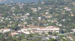
The Lower Riviera


309 acres
1,100 dwellings per acre

The Lower Riviera includes the hills below Alameda Padre Serra Blvd. between Old Mission and Canon Perdido streets. It is primarily residential, mostly single family, at around 3 units per acre, but with pockets of more intensive duplex and multifamily housing up to 12 units per acre in some places.

The area around Grand Avenue developed as university housing when UCSB occupied a small teaching collage above Alameda Padra Serra (where I attended kindergarten as a private Christian school). In this section single family homes were converted to multiple unit apartments. Due to the narrow streets and limited off-street parking (intended for single families) traffic is now problematic.

The city's current plan for Grand Ave is to leave the housing structured as it is, but to increase inspection to elliminate any off-the-books subdivisions. Additionally the city will encourage more off-street parking facilities such as underground garages for new developments.

The Lower Riviera is served by Roosevelt Elementary, Hillside (Orpet) Park, the County Bowl, and St. Francis Medical Center (closed since 2003).

Political Context


The redevelopment of the St. Francis Medical Center has become a hot-button issue in local Santa Barbara politics. A neighborhood advocacy group sprouted to challenge the current plans and the city has held multiple public hearings and inquiries into the matter. Construction has been delayed for nearly 4 years.

The neighbors' main concerns are the loss of the historic hospital. The site has been in continuous use as a medical facility for more than a century. Many local people have been born and died in this building over the years.

In addition, the site holds a social role as a source of non-corporate care. My own father was treated at the hospital back in the 60's and reports that it was one of the most positive medical experiences of his life. The religious source of the facility may have helped focus treatment on the patients instead of the profits.

However, the small size and personal focus of the hospital may have also contributed to its financial problems. The hospital was unable to secure large government and private health care contracts such as university and county employees. They were also unable to secure many specialists or to attract a large endowment. When the buildings came due for more seismic retrofits in 2000 the nuns began to look for a partner or a buyer and eventually sold the property to the successful and growing chain of Cottage Health Systems.

Accepting that the medical uses will be lost the neighbors still have concerns about the loss of public access to a lush site with great views of the city and the ocean. Neighbors have been allowed to park on the site, walk their dogs, and cut plant clippings. The prospect of the site being developed into private housing is a net loss for the community.

As a last gasp to hold up development the neighbors have settled on the possible historic nature of the buildings and the potential for environmental damage due to demolition and removal of debris. They have challenged both the historic and the environmental impact studies conducted by Cottage Health and the city. The neighbors have even hired outside architects and lawyers to review redevelopment of the old buildings as a potential alternative.

Cottage Health Systems argues that the building has been remodeled so extensively over the years that it does not represent a particularly good example of its period architecture (Hispanic) and in a city filled with Hispanic structures it is not a unique example of its style. They have also noted that the proposed future residents, hospital workers, have already rejected the notion of living in a building that even remotely reminds them work.

The remaining concerns regarding environmental impact from redevelopment remain an issue. However, any plans for the hospital grounds will require significant work and will have similar impacts to demolition and rebuilding. A successful alternative would need to address both the environmental and social concerns for the larger Riviera community.

Wednesday, March 21, 2007

Local Planning


Starting around 1975 residents of Santa Barbara planned to contain and limit growth. A stable population of 85,000 was set as the goal and residential properties were then "down-zoned" decrease density.

In 1989 the city re-examined its planning goals. Commercial development, which had not been "down-zoned", had outstripped residential growth. Local defense industries and medical services were strong draws to Southern Californians. Thus the city was pulled into the development orbit of the Los Angeles area in spite of its resistance.

Real estate prices forced lower income and younger age groups out of the city while existing residents retired out of the workforce. Many current workers now live outside the city (in areas such as Santa Rosa and Ventura) and commute in. This causes periodic transportation problems and threatens future productivity and competitiveness of the city.

Today the city recognizes that its economic and cultural health rely on increased affordable housing. With the natural geographic limitations of the hills and the ocean this increase in housing will require an increase in housing density and new types of living arraignments.

Significant infill has already pushed multiple homes into existing single family lots surrounding downtown. The house my family lived in on West Islay Street was a duplex when we lived there in the 70's. Today three additional units have been built into a new building in what was once our backyard.

The redevelopment of St. Francis Medical Center into housing is an opportunity to showcase a possible model for future infill and redevelopment for the city. An environmentally and socially sustainable project could reset local attitudes towards the kind of increased density and mixed-use development that will be required to manage the growth that Santa Barbara now realizes is inevitable and even desirable for long term civic health.

Tuesday, March 20, 2007

Demographics


The city's population has hovered around 100,000 people over the last decade. There are nearly 400,000 in the county. With a density of 142 people per square mile.

City ethnicity is primarily European (60%), African (30%) and Asian (2%). The most common ethnic heritage is German, followed by English and Irish (roughly 10% each).

Over 40% have a college degree and 15% have post graduate education.

About 50% of residents are married, 11% have been divorced, and 5% are widowed.

More than 30% have children under the age of 18 living at home.

In the city 14% of residents are over 65 and 20% more are between 45 and 65 years old.

Major industries in the area have been defense related (declining) or health care related (increasing).

Roughly 5% of males and 15% of females work in health care.

Median family income in Santa Barbara is around $45,000.

Average 3-bedroom homes cost more than $1,000,000. And rent for a 2-bedroom 2-bath apartment is roughly $2100 a month.

In 1996 it cost $160,000 to build an average sized single family home in the area, in 2005 it cost nearly $300,000. However, most homes cost between $300k and $750k.

In the last few years the city has been losing population to its northern neighbor Santa Maria where housing costs are roughly half.

The common stereotype about Santa Barbara is a local motto that the city is filled with "the newly wed and the nearly dead".

Monday, March 19, 2007

Geography


Santa Barbara sits in a dish of hills facing the ocean to the south.

The city center follows State Street from Stearns Wharf, accross Hwy 101, up to the Mission at the base of the Riviera hills.

The Riviera occupies the foothills of the Santa Ynez Mountains which run from the SE to the NW from Los Angeles to Monterey.

The coastline here (uniquely) faces south and is sheltered by the Channel Islands a few miles out to sea and the mountains and hills behind.

The region recieves over 300 days of sunshine a year, between 10-15 inches of rain (higher during El Nino), and the average temperature is 70 degrees.

The climate is considered by gardners to be "Mediterranean" with mild seasons, good soil, and plenty of sunshine. More varieties of trees can grow here than anywhere else in the US.

Sunday, March 18, 2007

City History


Santa Barbara Channel was named the by the Spanish explorer Sebastian Viscaino on Dec 4th (St. Barbara’s Feast Day) in 1602.

The coastline was inhabitted by branches of the Chumash tribes who fished and ranched in loose bands from what is now San Luis Obispo to Ventura.

In the 18th century the Spanish settled a serries of settlements, El Camino Real or "the Royal Road", that stretched from San Diego to San Francisco.

The Presidio and the Mission at Santa Barbara were founded by the Franciscan Padre Junipero Serra in 1782 and 1786.

The City of Santa Barbara was established in 1797 with land grants to retired soldiers from the Presidio.

In 1822 the area changed from Spanish to Mexican control, and in 1848 the area was ceded to the United States.

When the train line opened to San Francisco in 1901 the city population doubled to nearly 6,000… today it is around 100,000.

After the 1925 earthquake destroyed much of downtown, the area’s historic architecture was given greater attention and future designs have been encouraged, or required, to fit into several local styles including the Hispanic State Street (El Pueblo Viejo), Bungalow Haven, the Lower Riviera, and the Victorian Landmark District.